
Parcel 10-2N-23-0000-0016-0020
Owners
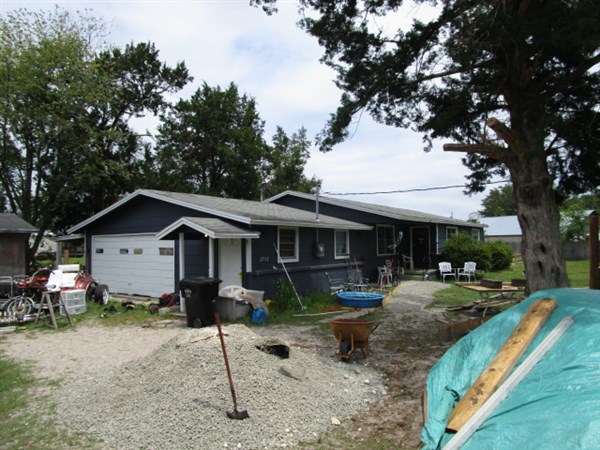
2752 RUBY DR
HILLIARD, FL 32046
Parcel Summary
| Situs Address | 2752 RUBY DR |
|---|---|
| Use Code | 0100: SINGLE FAMILY |
| Tax District | 6: Drainage Dist |
| Acreage | 0.800 |
| Section | 10 |
| Township | 2N |
| Range | 23 |
| Subdivision | |
| Exemptions | HX: Homestead (196.031(1)(a)) (100%) HB: Homestead Banded (196.031(1)(ab) (100%) |
Short Legal
PT SEC SW1/4 IN SEC 10-2N-23EIN OR 2554/368
(EX R/W OR 248/530)
Values
| 2025 Certified Values | 2026 Preliminary Values | |
|---|---|---|
| Land Value * | $36,000 | $32,000 |
| (+) Improved Value | $127,052 | $132,225 |
| (=) Market Value | $163,052 | $164,225 |
| (-) Agricultural Classification | $0 | $0 |
| (-) SOH or Non-Hx* Capped Savings ** | $14,200 | $11,354 |
| (=) School Assessed Value | $148,852 | $177,871 |
| County Assessed Value | $148,852 | $152,871 |
| (-) School Exemptions | $25,000 | $50,000 |
| (-) Non-school Exemptions | $50,722 | $51,411 |
| (=) School Taxable Value *** | $123,852 | $127,871 |
| (=) County Taxable Value | $98,130 | $101,460 |
Document/Transfer/Sales History
| Instrument / Official Record | Date | Q/U | V/I | Sale Price | Grantor | Grantee |
|---|---|---|---|---|---|---|
| WD 2554/0368 | 2022-04-06 | Q | Improved | $169,000 | AUSTIN STEVEN P | PEARSON MATHAN SCOTT |
| WD 2147/1324 | 2017-09-07 | Q | Improved | $94,000 | MG LEHIGH ACRES HOLDING LLC | AUSTIN STEVEN P |
| SW 1933/0540 | 2014-07-24 | U | Improved | $26,500 | U S BANK N A TRUSTEE | MG LEHIGH ACRES HOLDING LLC |
| CT 1866/1057 | 2013-07-08 | U | Improved | $100 | CLERK OF COURT | US BANK NATIONAL ASSOCIATION TRUSTEE |
| WD 1349/1102 | 2005-09-13 | Q | Improved | $125,000 | MCINTOSH HAROLD L & SANDRA G | SCHIRMER LAWRENCE & SHELBY ARLENE |
| WD 1109/1288 | 2003-01-27 | U | Improved | $65,000 | BARBER LOTTIE B & GEORGIA ANNE ZETMEIR | MCINTOSH HAROLD L & SANDRA G |
| QC 1106/0093 | 2003-01-08 | Q | Vacant | $100 | BARBER JAMES & LADONNA | BARBER LOTTIE BELLE ETAL |
| QC 1093/1594 | 2002-11-12 | Q | Improved | $100 | BARBER LOTTIE B | ZETMEIR GEORGIA A & LOTTIE B BARBER |
Buildings
Building # 1
| Heated Sq Ft | Year Built | Value |
|---|---|---|
| 1537 | 1973 | $131,825 |
Structural Elements
| Type | Description | Code | Details |
|---|---|---|---|
| EW | Exterior Wall | 08 | WD ON PLY |
| EW | Exterior Wall | 15 | CONC BLOCK |
| RS | Roof Structure | 03 | GABLE/HIP |
| RC | Roof Cover | 03 | COMP SHNGL |
| IW | Interior Wall | 04 | PLYWOOD |
| IF | Interior Flooring | 14 | CARPET |
| IF | Interior Flooring | 08 | SHT VINYL |
| AC | Air Conditioning | 03 | CENTRAL |
| HT | Heating Type | 04 | AIR DUCTED |
| BDR | Bedrooms | 2.00 | |
| BTH | Bathrooms | 2.00 | |
| FR | Frame | 03 | MASONRY |
| STR | Stories | 1. | 1. |
| BUD8 | BUD8 Adjustment | 06 | DIST 1D |
Extra Features
| Code | Description | Length | Width | Units | Unit Price | AYB | % Good Condition | Final Value |
|---|---|---|---|---|---|---|---|---|
| 0751 | UOP | 20 | 10 | 200.00 | $10.00 | 1992 | 20% | $400 |
Land Lines
Personal Property
None
TRIM Notices
Property Record Cards
Disclaimer
The Nassau County Property Appraiser's Office makes every effort to produce the most accurate information possible. No warranties, expressed or implied, are provided for the data herein, its use or interpretation. The information contained herein is for ad valorem tax assessment purposes only. The Property Appraiser exercises strict auditing procedures to ensure validity of any transaction received and posted by this office but cannot be responsible for errors or omissions in the information received from external sources. Due to the elapsed time between transactions in the marketplace, and the time that those transactions are received from the public and/or other jurisdictions, some transactions will not be reflected.